Associating web services
The web services must be entered as resources associated with a record. Third party applications can use the corresponding web service once it has been correctly entered. Proceed as follows for each type of service.
If the layers parameter is not specified in the URL, an error is displayed in the OpenCatalog interface:

Tip: your web services must be specifically formatted in order to be "used" properly by external platforms such as geOrchestra or Prodige. They must be formatted in a particular way. See the appendix on this subject.
Associating a WMS flow
The WMS Web Map Service protocol is an OGC (Open Geospatial Consortium standard that can be used to obtain an image of the geographic data required via a request.
- Add an associated resource;
- Choose type
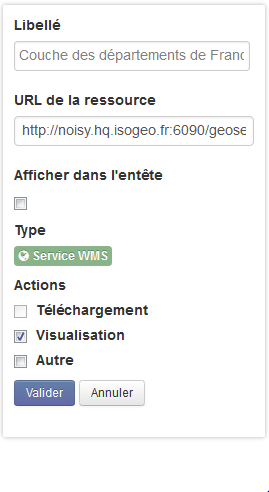
WMS Service; - Enter the URL corresponding to the service, for example: http://clc.developpement-durable.gouv.fr/geoserver/wms;
- Add the name of the layer to display via the layers parameter: ?layers=clc:CLC06 for example. You can obtain the names of the layers available using the GetCapabilities action: ?request=GetCapabilities
- Click on
Validate; - In the actions of the associated resource, select the
Displayoption; - Click on
ValidatethenSavein the record.
Rendering in OpenCatalog
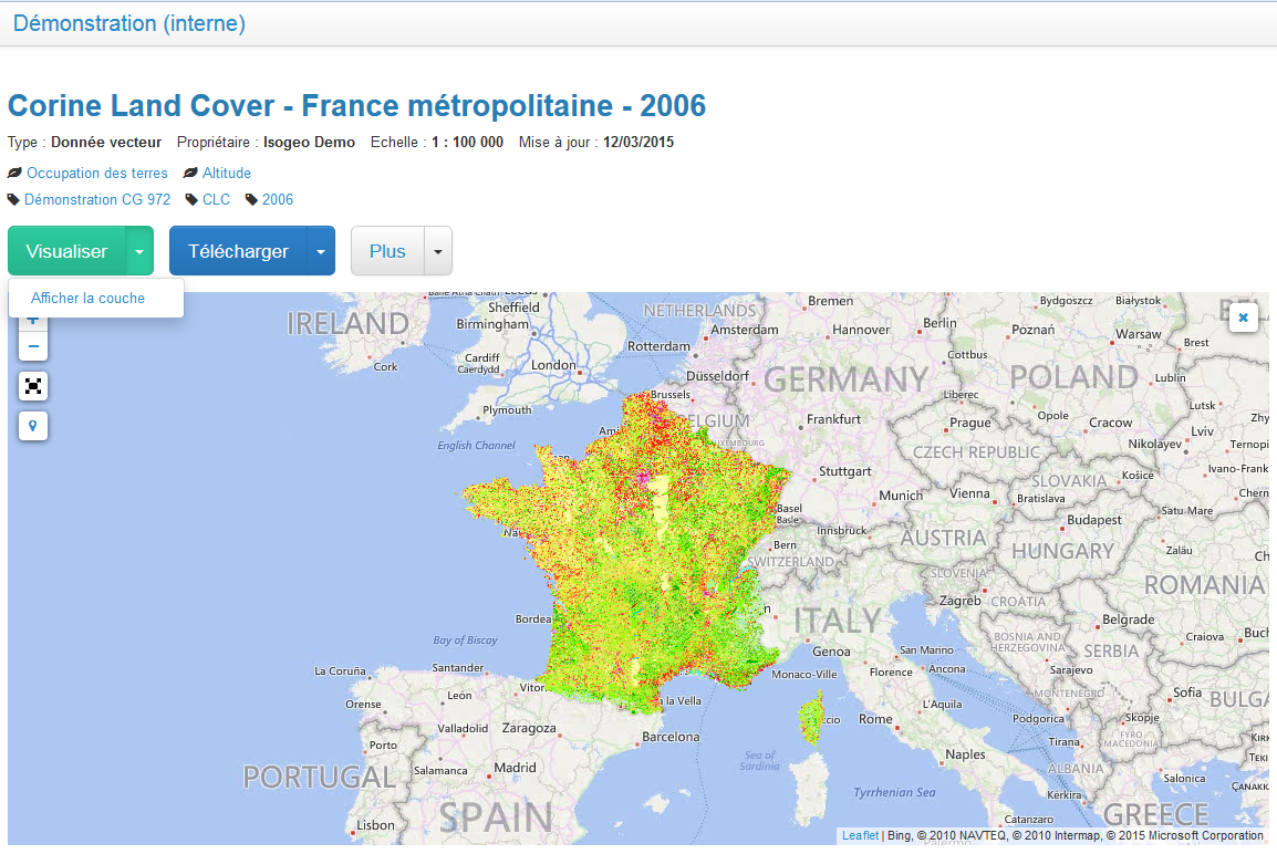
See an online demonstration where the flow used is that provided by the MEDDE (French Ministry of Ecology, Energy and Sustainable Development): data from 2006 Corine Land COver on mainland France.
Associating a WFS flow
The WFS Web Feature Service protocol is an OGC (Open Geospatial Consortium standard that can be used to obtain an image of the geographic data required via a request. It is then up to the mapping library to represent these entities.
Tip: for security reasons, OpenCatalog can only display Web Feature Services that accept the JSONP format. See the appendix on this subject.
- Add an associated resource;
- Choose type
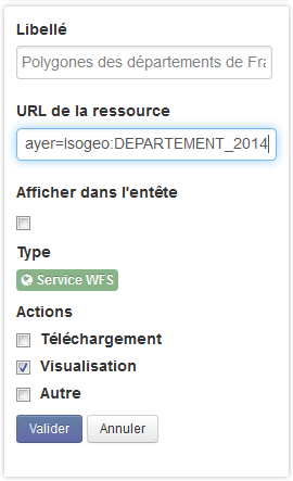
WFS Service; - Enter the URL corresponding to the service, for example: http://noisy.hq.isogeo.fr:6090/geoserver/Isogeo/ows;
- Add the name of the layer to display via the typeName parameter: ?typeName=Isogeo:DEPARTEMENT_2014 for example; You can obtain the names of the layers available using the GetCapabilities action: ?request=GetCapabilities;
- Click on
Validate; - In the actions of the associated resource, select the
Displayoption; - Click on
ValidatethenSavein the record.
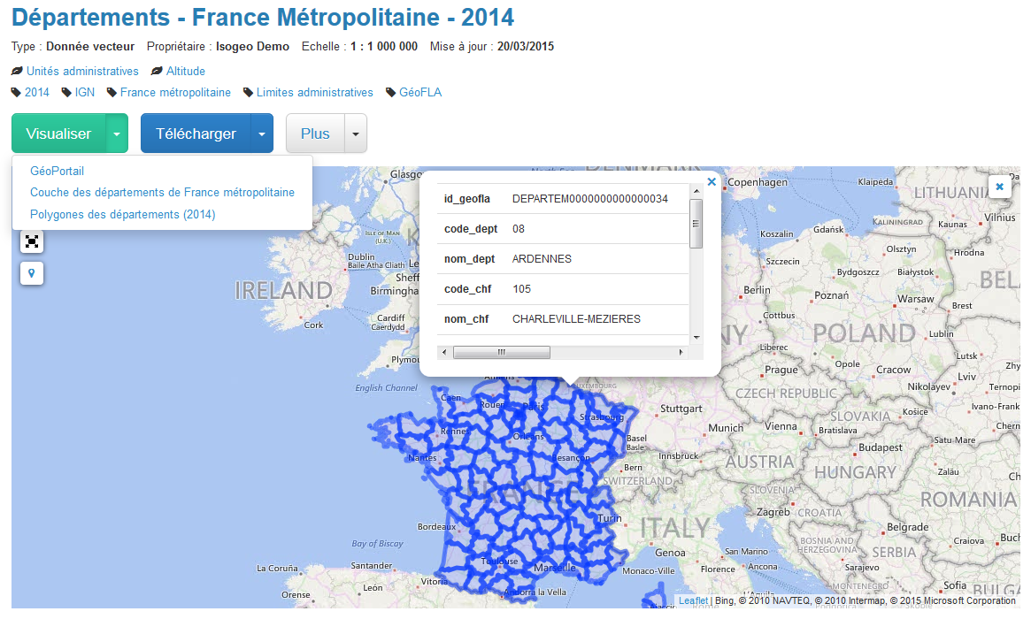
Rendering in OpenCatalog
Here is an online example: mainland France departments in 2014.
Associating a WMTS flow
The WMTS Web Map Tile Service protocol is an OGC (Open Geospatial Consortium standard that can be used to obtain an image generated previously by the mapping server via a request.
The WMTS must accept EPSG 900913 in order to work in OpenCatalog.
- Add an associated resource;
- Choose type
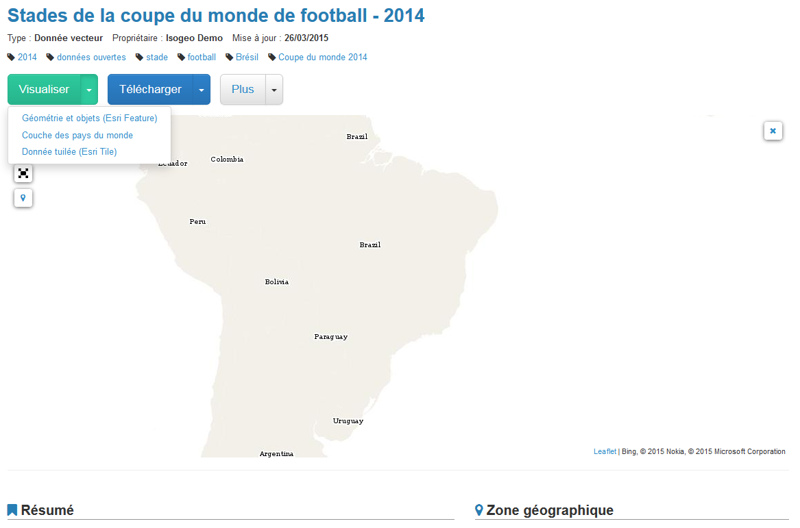
WMTS Service; - Enter the URL corresponding to the service, for example: http://suite.opengeo.org/geoserver/gwc/service/wmts;
- Add the name of the layer to display via the layers parameter: ?layers=opengeo:countries for example. You can obtain the names of the layers available using the GetCapabilities action: ?request=GetCapabilities;
- Click on
Validate; - In the actions of the associated resource, select the
Displayoption; - Click on
ValidatethenSavein the record.
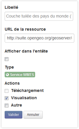
Rendering in OpenCatalog
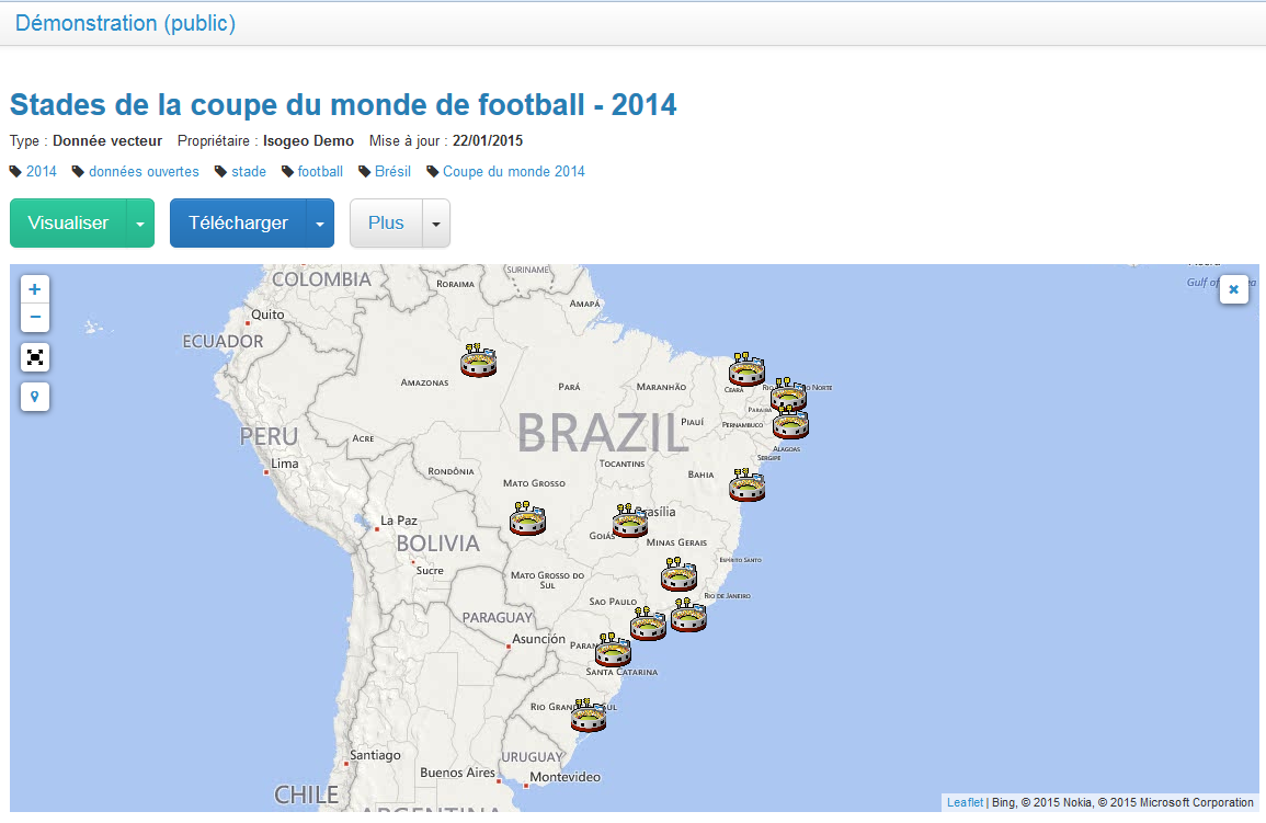
Here is an online example: tiled layer of the countries attached to data corresponding to the stadiums of the 2014 FIFA World Cup.
Associating an Esri Map flow
An Esri Tiled Map service can be used to obtain the geographic entities required via a request. This type of service is provided by ArcGIS for Server or ArcGIS Online, i.e. tools developed by the company Esri.
- Add an associated resource;
- Choose type "Service ESRI Map Service";
- Enter the URL corresponding to the service, for example: http://noisy.hq.isogeo.fr:6080/arcgis/rest/services/USA_DATA/Airports/MapServer/0;
- Click on
Validate; - In the actions of the associated resource, select the
Displayoption; - Click on
ValidatethenSavein the record.
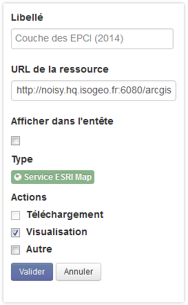
Rendering in OpenCatalog
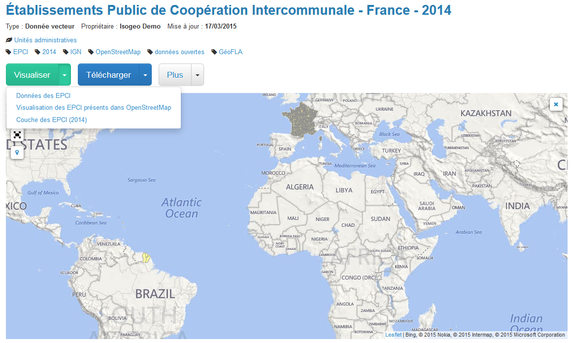
Here is an online example: EPCI (Public Establishment for Intermunicipal Cooperation) data in 2014 taken from OpenStreetMap.
Associating an Esri Feature flow
An Esri Tiled Map service can be used to obtain the geographic entities required via a request. This type of service is provided by ArcGIS for Server or ArcGIS Online, i.e. tools developed by the company Esri.
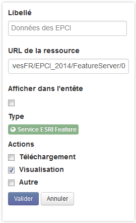
- Add an associated resource;
- Choose type "Service ESRI Feature Service";
- Enter the URL corresponding to the service, for example: http://services1.arcgis.com/ApmCsFVnpW3bVGYw/arcgis/rest/services/Ports/FeatureServer/0;
- Click on
Validate; - In the actions of the associated resource, select the
Displayoption; - Click on
ValidatethenSavein the record.
Rendering in OpenCatalog
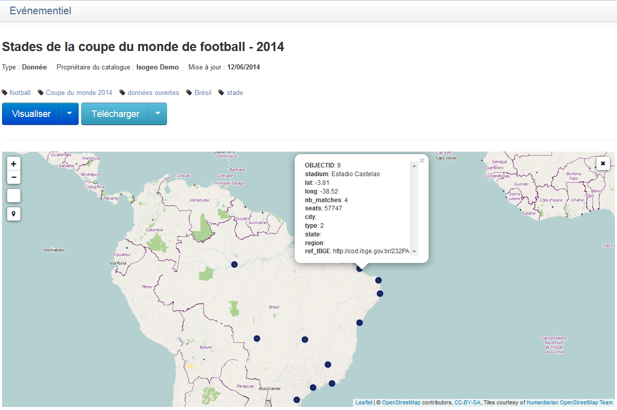
Here is an online example: data corresponding to the stadiums of the 2014 FIFA world cup.
Associating an Esri Tiled Map flow
An Esri Tiled Map service can be used to obtain the geographic entities required via a request. This type of service is provided by ArcGIS for Server or ArcGIS Online, i.e. tools developed by the company Esri.
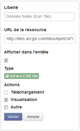
- Add an associated resource;
- Choose type "Service ESRI Tile Service";
- Enter the URL corresponding to the service, for example: http://tiles.arcgis.com/tiles/ApmCsFVnpW3bVGYw/arcgis/rest/services/Populated_Places/MapServer;
- Click on
Validate; - In the actions of the associated resource, select the
Displayoption; - Click on
ValidatethenSavein the record.
Rendering in OpenCatalog
Here is an online example: data corresponding to the stadiums of the 2014 FIFA world cup.
